Find By:

A map indicating temperature rises in New York City.

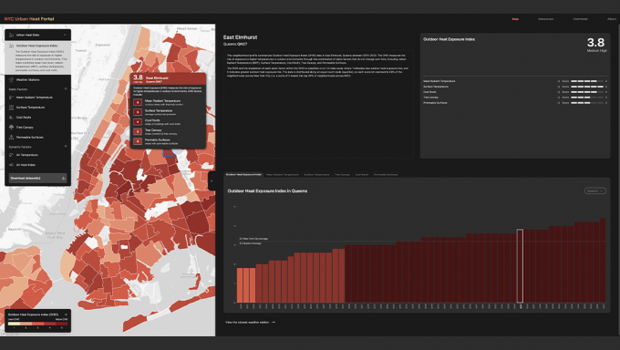
Urban heat portal aims to tackle rising temperatures, protect at-risk residents

Doug Tallamy at left and Nina-Marie Lister at right.

Stuckeman Research Symposium explores the role of animals in design, ecology

A young shirtless man rowing a boat through a floodplain community among houses on stilts in Iquitos, Peru.

Stuckeman School exhibition to showcase urban floodplain communities in Peru

Victor Meesters at left and Margo Sulnier at right.

Stuckeman School to host virtual architecture lecture, research open house

IEE seed grants awarded to 11 interdisciplinary projects

Eliza Pennypacker, at center, accepts a certificate from a woman on her right and a man on her left.

Landscape architecture faculty honored by international education organization

At left, a photo from showing an inlet that was formed during Superstorm Sandy on the Rhode Island coast. At right is a visualization of a model simulation of the same event.

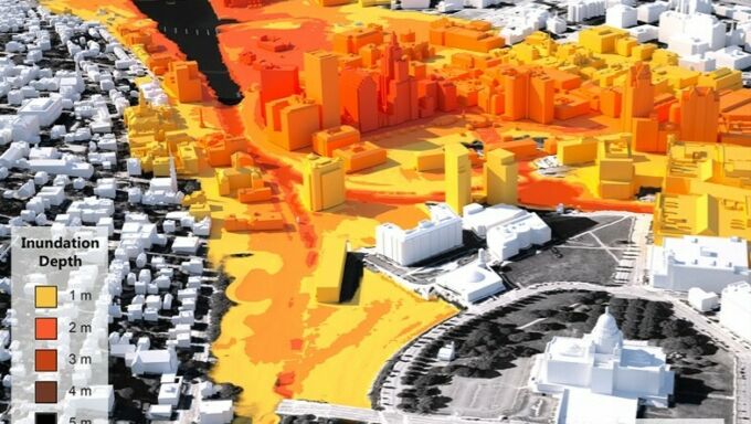
Penn State researcher and partners earn collaborative coastal resilience grant

A three-dimensional visualization showing inundation depths in Providence, Rhode Island, from a hypothetical storm dubbed "Hurricane Rhody." Darker colors indicated deeper inundation levels. Peter Stempel, associate professor of landscape architecture, creates visualizations such as the one above to help coastal communities quickly understand the risks posed by hurricanes and other coastal storms. Credit: Image courtesy of Peter Stempel. All Rights Reserved.

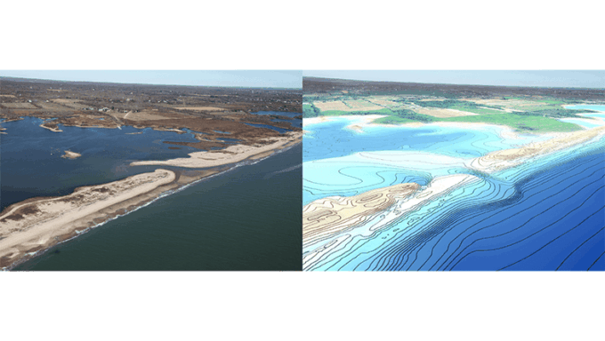
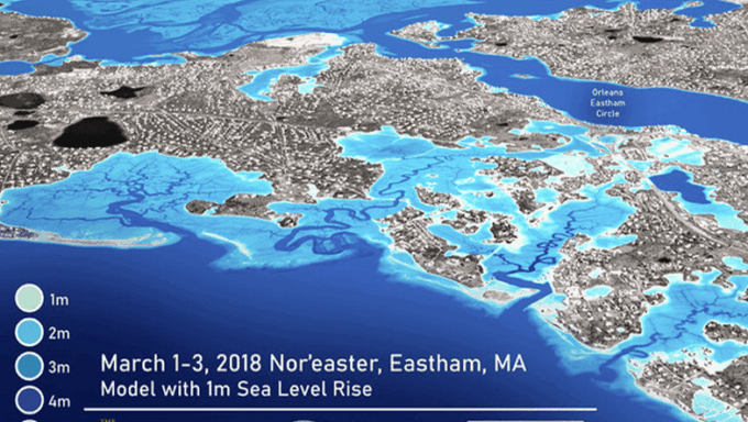
Q&A: Seeing coastal storm impacts in advance can help communities prepare

A cluster of houses nearly on top of one another in Medellín, Colombia.

Stuckeman symposium to highlight issues surrounding displacement in architecture

Traffic built up heading into New York City.

NASA-funded research seeks to address vulnerability to extreme heat in cities

A close up photo of a man's hand pointing at a map showing housing clusters,

Stuckeman research units to host lecture series highlighting design research

The appearance of the neighborhood urban forest cover of the Strip District and East Pittsburgh, PA, is pictured as seen from Bedford Hill looking toward the David McCullough Bridge

Interdisciplinary research team receives IEE grant for urban forest research

A poster with the title "Social-ecological history supporting a resilient Hampton"

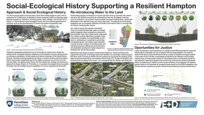
Interdisciplinary Penn State team places second in coastal design competition

A rendering of a studio desk space with a white concept board overlay and two Zoom screens of the instructor.

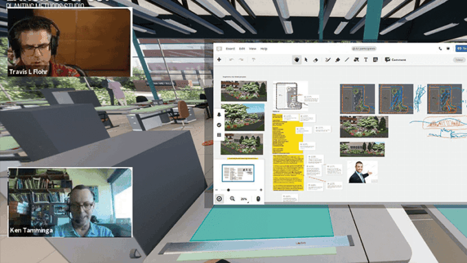
Stuckeman School professor uses virtual reality to expand studio environment

Realistic 3D visualization for Eastham, Massachusetts, along the Cape Cod National Seashore using Advanced Circulation (ADCIRC) modeling results of the March 2018 Nor'easter with 1.0 m sea level rise.

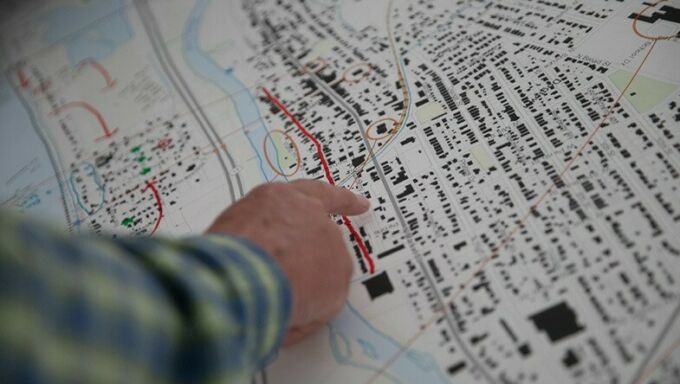
Penn State partners on project to help protect coastal communities

Andy Cole

Arts and Architecture appoints interim head of landscape architecture

Keith Bowers, left, talks with Andy Cole and Kendall Mainzer, at. right.

New podcast engages research to improve the world’s ecological health