Q&A: Seeing coastal storm impacts in advance can help communities prepare

A three-dimensional visualization showing inundation depths in Providence, Rhode Island, from a hypothetical storm dubbed "Hurricane Rhody." Darker colors indicated deeper inundation levels. Peter Stempel, associate professor of landscape architecture, creates visualizations such as the one above to help coastal communities quickly understand the risks posed by hurricanes and other coastal storms. Credit: Image courtesy of Peter Stempel. All Rights Reserved.

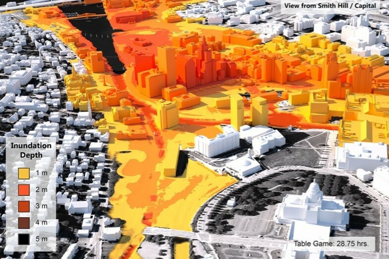
Knowing the potential dangers posed by storm surge and high winds before a storm hits can help coastal communities and emergency responders prepare. Visualizations showing projected storm impacts can make the complex science behind the projections easy to understand and immediately available to individuals in the storm's path, according to Peter Stempel, associate professor of landscape architecture.

Penn State News spoke with Stempel, who works with colleagues at Penn State and the Department of Homeland Security's Coastal Resilience Center for Excellence to transform intricate scientific models into easy-to-understand visuals communicating the science to coastal communities.