Geodesign, M.P.S.
Geodesign, M.P.S. (+Graduate Certificate)
Become a leader in designing our sustainable future.
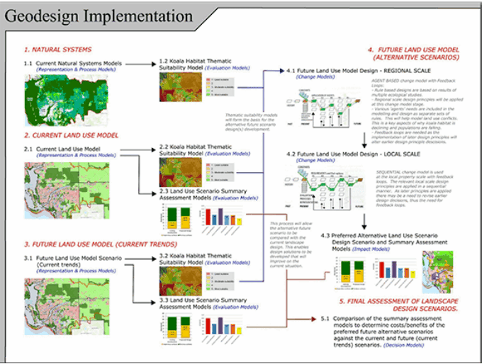
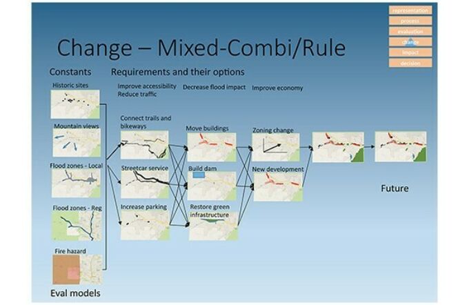
Geodesign is the term for a revolutionary design process having an impact worldwide. Its remarkable success lies in its unique combination of science and design: starting with geospatial information, engaging interdisciplinary collaborators, and building consensus among stakeholders, geodesign is changing the way we design for a sustainable future.
Earn an M.P.S. or graduate certificate in Geodesign
Offered wholly online through Penn State World Campus, the 35-credit M.P.S. in Geodesign prepares you to become a go-to expert in addressing complex environmental design challenges in contexts from urban design to conservation planning.
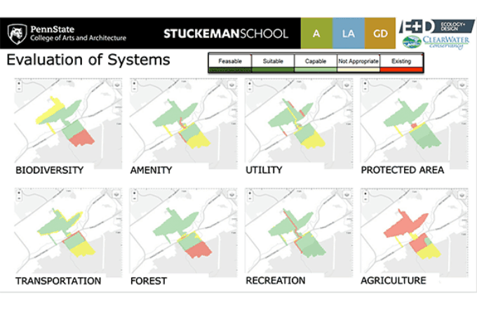
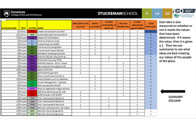
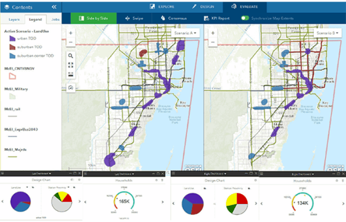
Guided by an international advisory board of experts, our program brings together the best geodesign faculty in the nation with students from around the world. Thanks to our online, interactive platform, each class collaborates on exciting, real world land use challenges in places ranging from Yellowstone National Park to the city of Utica, New York.
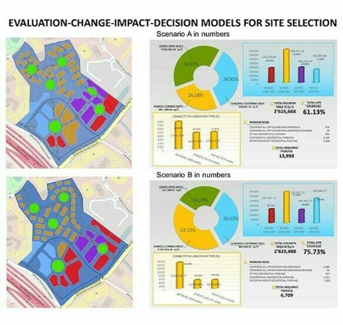
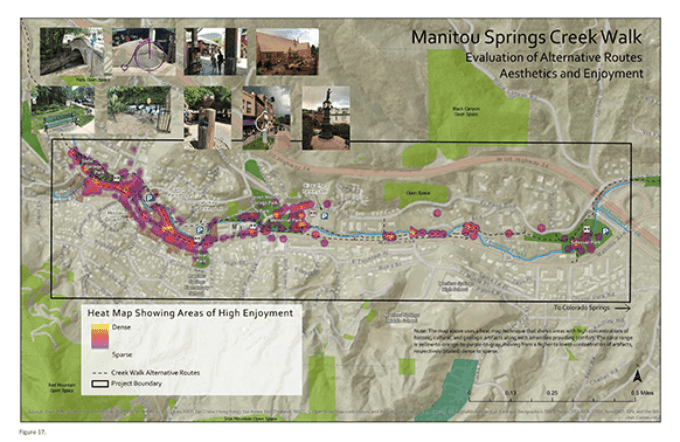
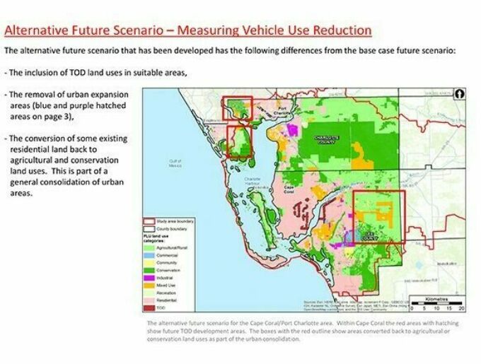
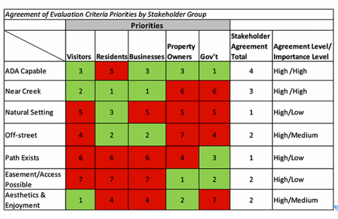
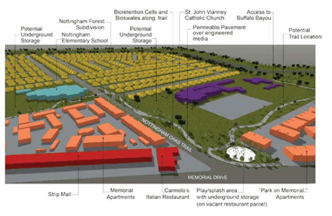
Students in the M.P.S. program also undertake a capstone project of their choice; topics to date range from “Designing Koala-friendly Landscapes in Eastern Australia” to “Breaking the Cycle of Floods in Houston, Texas.”
You may choose either the M.P.S. program or the 14-credit Graduate Certificate in Geodesign program.
Is Geodesign right for you?
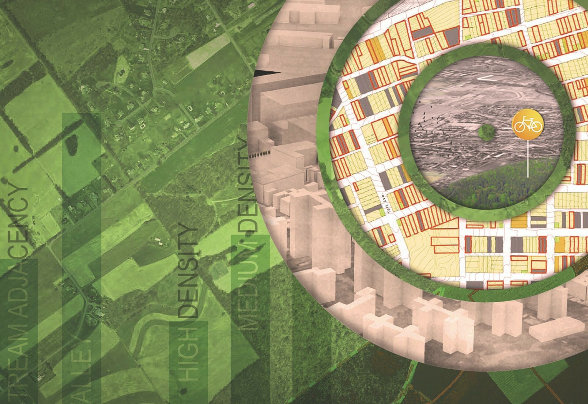
Geodesign weds the analytical power of geographic information systems (GIS) with a robust design process to ensure land use design and planning that is socially, environmentally, and economically responsible.
According to Jim Sipes, landscape architect and Penn State geodesign instructor, “I think geodesign is the solution to wicked problems. Good ideas require complex, creative problem-solving skills in order to arrive at smart, comprehensive decisions. If we’re going to change the world, this is what we’ve got to do.”
Jack Dangermond, founder of Esri and creator of Geodesign software says, “I’m very excited about the program at Penn State. . . it’s pushing the edge of where the world needs to go with respect to creating a new generation of students that can go out into the world and find jobs immediately.”
Learn more about the M.P.S. and our online graduate certificate via the World Campus website.
Learn More
Quick Facts
Considering the M.P.S. in Geodesign at Penn State? Consider this.
- Our Geodesign program prepares you to be a leader in designing our sustainable future.
- You can ignite your current expertise by adding geodesign to your skill set.
- You are able to earn the M.P.S. from your current location in your spare time.
- Not sure you can commit to a master’s degree? Consider the graduate certificate program.
- Take one course to “test the waters;” completed credits transfer to the M.P.S. degree.